

Participatory mapping: a community-driven approach
When a cyclone or a flood strikes, every second counts. But for early warning systems to truly save lives, and for adaptation options to be sustainable, they must reflect on-the-ground realities. This is where participatory mapping comes in – a powerful, community-driven approach that places local knowledge at the heart of disaster preparedness and climate change adaptation.
In the coastal towns of Mananjary and Morombe, and in the low-lying areas of Mitsinjo, we are working hand in hand with local communities to develop this innovative methodology. The result? Early warning systems that are not only more accurate but also adapted to the unique challenges and strengths of each area, as well as adaptation options that make local communities more resilient.
What is participatory mapping, and why does it matter?
Participatory mapping is exactly what it sounds like: creating maps with communities, not just for them. It means using local knowledge to identify risks, resources, and safe zones. It is a collective effort to determine where floods hit the hardest, which paths remain usable, or where shelters are quickly accessible during a cyclone.
In Mananjary, for example, community members pointed out low-lying neighborhoods that experience rapid flooding during heavy rains – areas that do not always appear on standard flood maps. In Morombe, fishermen shared their first-hand knowledge of how storm surges affect their coastline. And in Mitsinjo, farmers mapped out critical routes connecting villages to higher ground, essential paths for evacuation.
Figure 1: Examples of co-created maps with residents of the Mitsinjo region
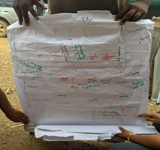
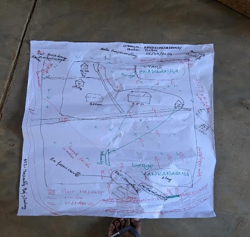
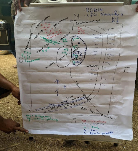
Source: REPRESA Team, September 2024
Identifying adaptation options: a key part of the process
Beyond improving early warning systems, participatory mapping has also helped identify adaptation options tailored to the specific needs of each community. Through our work, communities have been able to highlight areas where infrastructure improvements, resource management, and alternative livelihoods are essential for strengthening resilience to climate change.
Coastal protection and sustainable fishing in Morombe
In Morombe, for instance, fishermen identified critical zones most vulnerable to storm surges and erosion. In response, adaptation options such as coastal protection through mangrove restoration and sustainable fishing practices were proposed to safeguard both the local economy and the environment.
Improved drainage and flood control in Mananjary
In Mananjary, the low-lying neighborhoods identified through mapping were recognized as flood hotspots. In response, adaptation options such as improved drainage systems, flood barriers, and rainwater harvesting can be proposed to mitigate the impact of extreme weather events.
Climate-smart agriculture in Mitsinjo
In Mitsinjo, farmers mapped areas most sensitive to rainfall changes and flooding. To address these risks, adaptation options such as climate-smart agricultural practices can be introduced, including crop diversification, drought-resistant seeds, and soil conservation techniques.
How we did it: a collaborative process
To develop participatory mapping in these regions, we started with what communities already knew:
1 Workshops and storytelling
Residents shared their experiences of past disasters: where they sought refuge, which roads became impassable, and which areas were safe or dangerous. Their stories formed the backbone of the maps.
2 Walking together
Equipped with notebooks, community members and our team walked through fields, riverbanks, and urban areas. Together, we marked critical sites such as flood-prone zones, cyclone shelters, and even informal evacuation routes.
3 Drawing maps by hand
Sometimes the most effective tools are the simplest. In group sessions, we worked together to draw maps on large sheets of paper, layering local information and technical data.
4 Integrating technology
While the maps began with local knowledge, we used tools such as Geographic Information Systems (GIS) to overlay satellite imagery, topography, and weather data.
Bringing maps to life: real-world impact
So, what do these maps actually achieve?
- Targeted alerts - Identifying neighborhoods most at risk during cyclones
- Evacuation routes - Highlighting safe paths to higher ground
- Protecting livelihoods - Helping communities protect their livelihoods
- Identifying adaptation options - Revealing areas where adaptation measures can be implemented
- Building trust - Involving communities in the process
Figure 2: Map development with the participation of residents of Toliara
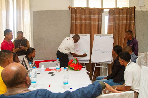
Source: REPRESA Team, August 2024
Why this matters for everyone
Participatory mapping is not just about creating better maps – it is about creating stronger communities. In a world where climate change is making extreme weather events more frequent, we all need to be better prepared. The work we have done in Mananjary, Morombe, Ankarafantsika, and Mitsinjo proves that when communities are part of the solution, the results are more effective and inclusive.
What's next?
Our work does not stop here. As the maps continue to evolve, we are committed to training local leaders and communities to update them regularly. We are also exploring ways to expand this approach to other regions, ensuring that the knowledge and tools developed in Mananjary, Morombe, Ankarafantsika, and Mitsinjo can inspire resilience across Madagascar and beyond.