

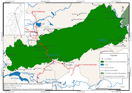
Location:
The site is located in northwestern Madagascar, within the Boeny Region.
Geographic coordinates:
It lies between longitudes 46°36’0.0’’ and 47°12’0.0’’ East, and latitudes 16°12’0.0’’ and 16°24’0.0’’ South.
Surface area:
The total area covers approximately 136,513 hectares (Source: SAPM/SAPM_AP_MADA.shp).
Administrative coverage:
The area falls within the districts of Marovoay and Ambato Boeny.
Management:
The site is managed by Madagascar National Parks (MNP) in collaboration with local communities, following a co-management approach.
Main road access:
National Road No. 4 (RN4) constitutes the main access route.
Neighboring municipalities:
The neighboring municipalities are Andranofasika to the east and Marosakoa to the west.
Villages within the park:
The villages located within the park boundaries include Ambodimanga, Ampijoroalava, Ampombolava, Ambikakely, and Befotoana.
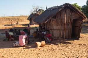 The indigenous population of the region is the Sakalava. In recent years, the area has experienced increasing migration from other parts of Madagascar, particularly from the deep south. This south-to-northeast migratory movement is primarily driven by the adverse climatic conditions affecting the migrants' regions of origin.
The abundance of arable land suitable for various agricultural activities, along with economic opportunities linked to the national park, draws many migrants in search of better living conditions.
Ankarafantsika National Park is located at an average altitude of 250 meters, with its highest points reaching 350 meters. The landscape is characterized by a mosaic of dense dry forests, wooded savannas, and lake ecosystems, giving the park a high level of ecological diversity.
This range of habitats supports an exceptional biodiversity, both terrestrial and aquatic. Among the park’s iconic features, Lake Ravelobe stands out as a notable attraction that contributes significantly to Ankarafantsika’s reputation.
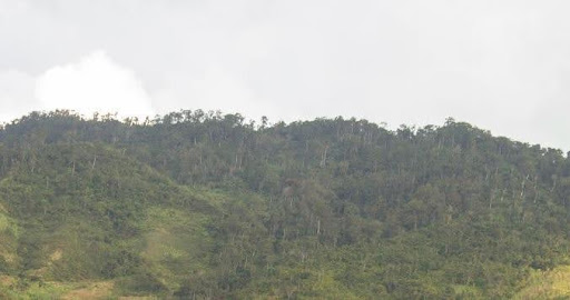
Ankarafantsika National Park hosts a wide variety of ecosystems, many of which are endemic to Madagascar. Notable biodiversity includes:
- 127 bird species, including 1 critically endangered (Madagascar fish eagle – ankoay), 6 endangered (e.g., Madagascar harrier and Madagascar grebe), and 2 vulnerable (e.g., Madagascar pratincole)
- 520 plant species, 352 of which (71%) are endemic to Madagascar: 2 critically endangered, 3 endangered, 1 vulnerable; 6 species are locally endemic (1%)
- 11 bat species, including 2 vulnerable (e.g., Madagascar flying fox)
- 13 amphibian species
- 8 lemur species, including 2 critically endangered, 1 endangered, and 2 vulnerable
- 3 carnivore species, 2 of which are vulnerable (e.g., fosa)
- 64 reptile species, including 5 locally endemic with 3 endangered; 3 additional endangered and 3 vulnerable species
- 11 other mammal species, including 1 locally endemic species classified as endangered
Even before considering natural phenomena such as climate change, human activities exert considerable pressure on Ankarafantsika National Park. The expansion of residential and agricultural areas is progressively encroaching on the park’s territory, threatening its ecological integrity.
Moreover, logging activities—primarily for charcoal production and construction—are intensifying. These practices are causing significant reductions in forested areas and are undermining ecosystem balance.
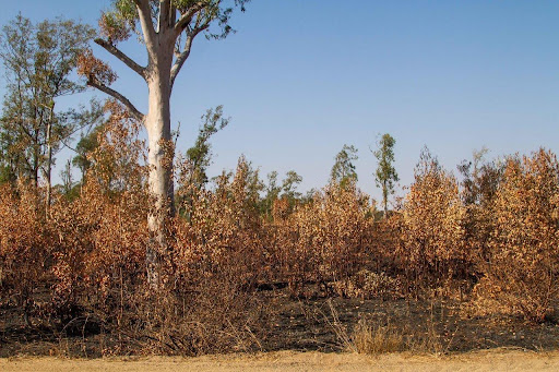
Source: ARAKE, September 2024
One of the most concerning consequences of these activities is the increasing incidence of forest fires, often of human origin. These fires—whether intentional or accidental—cause extensive damage to both the surface area and biodiversity, with often irreversible effects.
Among Madagascar’s many national parks, Ankarafantsika stands out for its exceptional biodiversity. However, it faces numerous threats, both natural and human-induced. To ensure the sustainable preservation of this ecological heritage, effective conservation and development strategies must be implemented. The success of these initiatives depends on strengthened collaboration among local communities, government authorities, and all relevant stakeholders.