

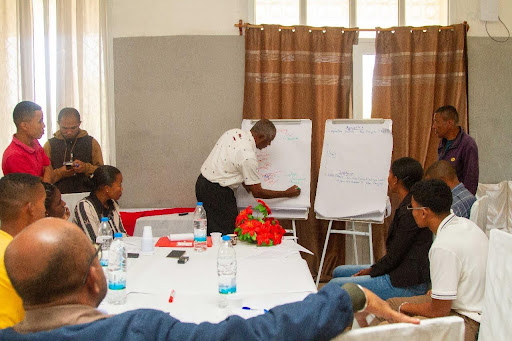
Participatory mapping is exactly what it sounds like: creating maps with communities, not just for them. It is about using local knowledge to identify risks, resources, and safe zones. Think of it as a collective effort to chart out where floods hit hardest, which paths remain passable, or where shelters can be accessed quickly during a cyclone.
In Mananjary, for example, community members pointed out low-lying neighborhoods that experience rapid flooding during heavy rains—areas that do not always show up on standard flood maps. In Morombe, fishers shared their firsthand knowledge of how storm surges affect their coastline. And in Mitsinjo, farmers mapped out critical routes that connect villages to higher ground, paths essential for evacuations.
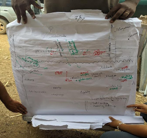
In addition to improving early warning systems, participatory mapping has also helped identify adaptation options that are tailored to the specific needs of each community. Through our work, communities have been able to highlight areas where infrastructure improvements, resource management, and alternative livelihoods are crucial to building resilience in the face of climate change.
- Coastal Protection and Sustainable Fisheries in Morombe
In Morombe, for example, fishers identified critical zones most vulnerable to storm surges and erosion. In response, adaptation options such as coastal protection through mangrove restoration and sustainable fishing practices were proposed to safeguard the local economy and the environment. These solutions help protect livelihoods while supporting ecosystem restoration. - Improved Drainage and Flood Control in Mananjary
In Mananjary, low-lying neighborhoods identified through mapping were recognized as hotspots for flooding. In response, adaptation options such as improved drainage systems, flood barriers, and rainwater harvesting can be proposed to mitigate the impact of extreme weather events. These interventions not only reduce flooding but also enhance water availability during dry periods. - Climate-Smart Agriculture in Mitsinjo
In Mitsinjo, farmers mapped areas most susceptible to changes in rainfall and flooding patterns. To address these risks, adaptation options such as climate-smart agricultural practices can be introduced, including crop diversification, the use of drought-resistant seeds, and soil conservation techniques. These practices help secure food sources and strengthen the local agricultural economy.
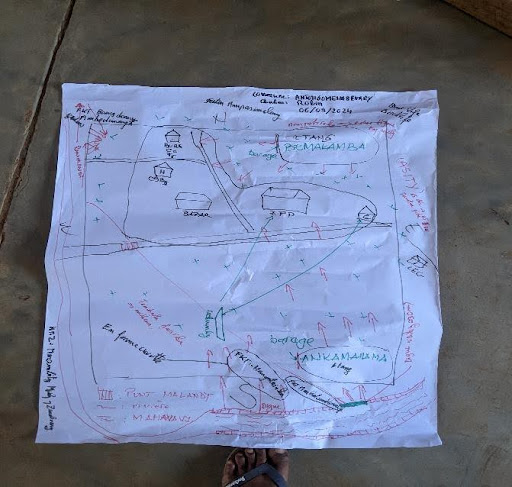
To develop participatory mapping in these regions, we started with what communities already knew:
- Workshops and Storytelling
Residents shared their experiences of past disasters—where they sought shelter, which roads became impassable, and which areas were safe or dangerous. Their stories formed the backbone of the maps. - Walking the Land Together
Equipped with notebooks, community members and our team walked through fields, riversides, and urban areas. Together, we marked critical sites like flood-prone zones, cyclone shelters, and even informal evacuation routes that only locals know. - Drawing Maps by Hand
Sometimes, the most effective tools are the simplest. In group sessions, we worked together to sketch maps on large sheets of paper, layering local insights with technical data. These hand-drawn maps were later digitized to create a more detailed, sharable resource. - Incorporating Technology
While the maps began with local knowledge, we used tools like Geographic Information Systems (GIS) to layer in satellite imagery, topography, and weather data. This combination of technology and community expertise ensures that the maps are both grounded and precise.
So, what do these maps actually accomplish?
- Targeted Warnings
In Mananjary, along with our collaborators, we intend to use the maps to identify neighborhoods most at risk during cyclones. This allows early warning messages to focus on the people who need them most, ensuring no one gets left behind. - Clear Evacuation Routes
In Mitsinjo, our community maps highlight paths to higher ground that are safe even during heavy rains. These routes will be included in evacuation drills, helping families practice where to go before the next disaster strikes. - Protecting Livelihoods
For fishers in Morombe, the maps showing areas most likely to experience storm surges will help them protect their boats and equipment ahead of adverse weather conditions. - Identifying and Implementing Adaptation Options
The maps not only identify risks but also reveal areas where adaptation measures can be implemented. From coastal protection measures to agricultural solutions and improved infrastructure, these adaptations are designed to minimize the impacts of climate change and strengthen community resilience. - Building Trust
Perhaps the biggest impact is less tangible but equally important: trust. By involving communities in the process, early warning systems feel like a shared project—not something imposed from the outside. This sense of ownership makes people more likely to act on warnings when they come.
And we are doing more!
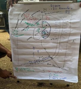
Participatory mapping is not just about creating better maps—it is about creating stronger communities. In a world where climate change is making extreme weather events more frequent, we all need to be more prepared. The work we have done in Mananjary, Morombe, Ankarafantsika and Mitsinjo proves that when communities are part of the solution, the results are more effective and inclusive.
Our work does not stop here. As the maps continue to evolve, we are committed to training local leaders and the communities to update them regularly. We are also exploring ways to integrate this approach into other regions, ensuring that the knowledge and tools developed in Mananjary, Morombe, Ankarafantsika and Mitsinjo can inspire resilience across Madagascar—and beyond. approche dans d'autres régions, en veillant à ce que les connaissances et les outils développés à Mananjary, Morombe, Ankarafantsika et Mitsinjo puissent inspirer la résilience à Madagascar et au-delà.